In the last article, I had promised to share my completed Campaign Guide for “Adventures in Anactoria”… but alas, I wasn’t able to complete it in time for this article. It will be shared, but I realized there was still a whole bunch of material that I hadn’t talked about that is going into this project. In previous articles we discussed how to handle player versus character knowledge to increase immersion and how to customize your PC creation rules to match the setting. In today’s blog, let’s look at other ways you can show your players what the world is like.
Pathfinderwiki: Your Best Friend
If you don’t already know, there is a wonderful online resource that is working to compile all of the player-friendly lore for Golarion in an easily-searchable format. PathfinderWiki was started by Alex Greenshields and Mark Moreland back in the mists of time as a fan-created labor of love for Golarion, and quickly grew to be the reference for Golarion lore. It has everything, from geography and politics to a Google Maps version of Golarion, profiles on NPCs and history and settlements and… pretty much everything. As more volunteers have joined it’s grown into a massive undertaking, made all the more daunted when the campaign’s timeline was advanced with the release of the Second Edition and the Lost Omens Campaign Setting material. I highly recommend you check it out for concise, well-researched summaries of whatever area your campaign is set in. (And, since you are interested in lore, you should register to edit the wiki yourself, and then add the material you research for your campaign! It’s not for fan-CREATED material, but if you’re already compiling the Second Edition changes for a certain area, you might as well add it to the site so others can benefit.)
I draw heavily on PathfinderWiki when compiling a campaign guide, using it as the skeleton to which I stitch my own details and creations. I also use it to provide the customized knowledge guides for each player based on their skill selections – not everything they’d know, of course, but the basic material that is directly relevant to the start of the campaign. So, the PC with a good Nature skill gets a list of all the nearby forests in the “Forests and Woodlands” category on the site, while the high Society PCs get the same information on the major settlements in the region. Sometimes during play when someone rolls really well on a Knowledge check, I just give them a link to the Wiki page and let them read it themselves.
The Lay of the Land
“A map is the greatest of all epic poems. Its lines and colors show the realization of great dreams.”
– Gilbert H. Grosvenor
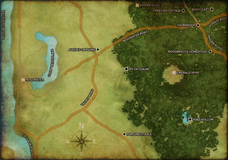
Another important aspect of the Campaign Guide are the maps I include. I provide players with a section of the Golarion map where the campaign takes place (with any spoilers removed), so they have a basic understanding of where we are. A full-page map of the starting settlement is my goal, and depending on where your campaign is set you may be able to find that on PathfinderWiki already. Many people arrange information in their head in some sort of map-like format anyway, so don’t underestimate the power of a good geographical representation of important areas that you can share with your PCs.
(I’m not talking about battle maps – those are important as well, but that comes later in the campaign. Up front, you want your players to know the lay of the land, what’s nearby, and what is farther away, as clearly as if they lived there themselves.)
If you can’t find existing Paizo material that covers what you need, there are often maps created by artists that may be available, but take care to contact the artist and discuss it with them before using their material, especially if your game is run online and you’ll be posting the map in a public-ish place. I have licensed maps from artists for campaigns before – it’s often quite inexpensive and gives you a non-exclusive license to use it, and supports the artist who created it. Many such maps are available on sites like DriveThruRPG or DeviantArt.
Or, you can try one of the great mapmaking programs out there and create your own. I grew up using a (sadly-discontinued) wonderful program called Dundjinni, which allowed you to drag-and-drop elements into a grid and had some basic layering capability to add (for example) transparent water over stone, or static lighting effects. Now, there are many to choose from, both computer-based and online, plus regular image processing programs from Photoshop to Gimp that can make amazing maps. Beware, though, for making detailed maps can quickly become the most time-consuming portion of campaign prep!
I’ve even commissioned an artist to create a map for me when I’m starting a major campaign on the scale of an adventure path, when I can’t find something already extant. It’s the most costly of the options, but also means you will get exactly what you want. As a GM with no end of ideas but no artistic skill whatsoever, it lets me “make” my own map conceptually by contracting out the artistic skills to someone else. At goes without saying that you should pay your artists fairly, though – don’t ask someone to put in dozens of hours of work for no remuneration.
Maps should always include a scale – whether it’s got a grid or not. You want your players to know whether the next town is an hour or a day’s walk away, and whether it takes a day or a week to get to the capital from their home village. The “Travel Speed” chart on page 479 of the Pathfinder Roleplaying Game Core Rulebook is your friend here.
Maps help define the world in a way unlike any other prop or reference you can provide your players, and helps set the stage of the adventures to come. As a GM you can extrapolate many details from a good map, such as the ruggedness of the terrain, local wildlife, or the weather, to help make your game as full of detail as you want. A good map helps immerse the players in the world, even when they’re not on a battle map. (This is especially important in virtual games, where if there isn’t some kind of visual up the players have nothing to look at.) Maps can be used to reduce travel time to a quick narration, as in the classic Indiana Jones movies, while still providing a sense of the world the PCs are passing through. They’re probably my number one gaming aid when it comes to designing or running new campaigns.
“I wisely started with a map, and made the story fit (generally with meticulous care for distances). The other way about lands one in confusions and impossibilities, and in any case it is weary work to compose a map from a story.”
– J.R.R. Tolkien

