I thought you said this desert was devoid of life? Aye, I did. So we are not going to encounter anything except possibly giant scorpions? Correct. Then what the bloody heck is a dwarven keep doing in this ravine?
Hello, welcome back to Groundbreaking! This is our 12 episode and 23rd(?) week together! Today was supposed to be a recap of where we had been, with a list of places and names to get us all on the same page before diving further into the details of the various things going on in the basin. But, um, oops! In going back through the list of locations that I had intended to include, and put out requests for names, I found some that never received proper mention and detailing, so here they are, in no particular order.
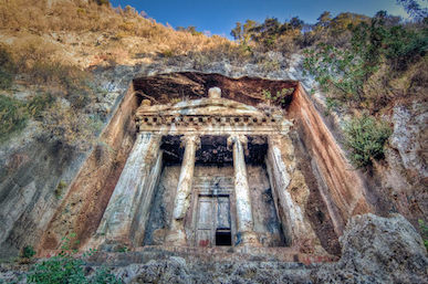 Nestled at the end of a wind and sand blasted ravine, the entrance to the dwarven keep has been carved directly into the walls of a natural hollow almost a hundred feet tall. Facing away from the sun, and back under the earth, the keep can only be seen when standing in the ravine in front of the hollow, and even then only if you have light. The ravine was original the first mine in the region, but when the dwarves took over, then moved their entire operation underground. To ensure that it was safe, and present a proper dwarven appearance, they converted the original mine into a proper dwarven keep, with all the defenses that goes along with it. This allows them to conduct official business and trade, as well as defend their claims with minimal effort.
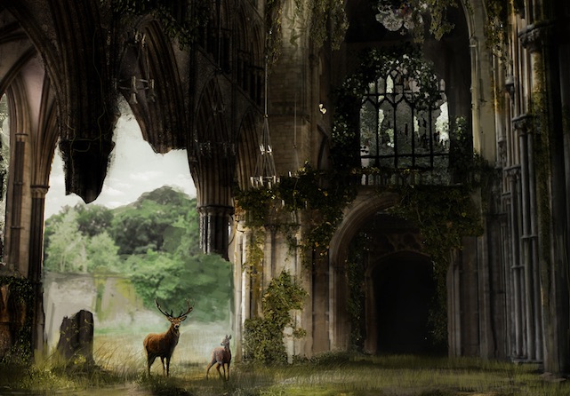
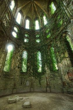 Hidden in the forest, surrounded by terrain that is impassable by all but the most devout of druids and the most worthy of rangers, lies an ancient cathedral. Rumored to be a remnant of the land from before the forest grew from the ash of the volcano, the cathedral is the oldest and most holy mortal construct in the caldera. Built for an deity that predates those currently worshipped in this land, it has weathered the millenia by becoming a part of the glade that it resides in. Many pieces of the building have been slowly replaced or reinforced over time by natural growths while never destroying or lessening the original beauty. It is unknown if ancient humans had a hand in building it or if it is perhaps the work of elven architects. Nobody can claim to have visited the site, as those that are free to visit it will never admit to knowing the location. Sightings of the cathedral, however, have consistent enough that many children are told by there parents that wandering the forest alone will have them stumbling into the cathedral where the boogie man will eat them. In all reports, however, the cathedral appeared to kind souls that were lost, providing them shelter from a storm or other danger, only to not be there when they awoke in the morning.
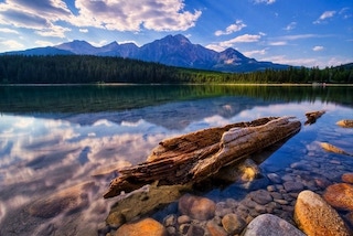 The southernmost border of the basin has a large depression just before the pass that leads down. This large depression collects water from the river that passes through the farmlands, creating a small lake that is fairly shallow. This gives it a calm look, with few waves outside the primary currents, and so most locals simply call it The Pond. Due to the amount of silt and other debris that is carried away from the farmlands, the depth, size, and borders of this lake are constantly changing as the waters slow down and the debris settles out. This has the effect of a primary path of the river through the lake that leads to where the waters eventually leave the basin in multiple streams to the south. Much of the other portions of the lake are rather shallow (often ten feet or less) that contain all manner of wetland creatures mixed in with various crossbred plants due to mixing soils that are carried from the farmlands. Many farmers are known to send workers to the lake to see if they can find a new strain that they can use to enhance or augment their crops further. Large storms that blow hard enough for a days or weeks are the only thing that is known to smooth out this lake’s bottom, essentially resetting the size and shape and contents with each major weather event.
As we dive into the locations in greater detail, we are going to start naming families and shops and heroes (old and new) from the region. This list is simply a starting point for the major locations that would be found on a map. If I decided to give the location a proper name, the bullet points after include who named it in parentheses (not all locations had names suggested, but I picked from suggestions where I had them).
- The Basin – The entire region
- Marathis’ Cradle (Seth laVox suggested Marath)
- The Mountain – The extinct volcano in the center of The Basin
- Mount Marathis
- The Caldera – The top of The Mountain
- Marathis’ Goblet
- Lake Caldera – The lake in The Caldera
- Caldera Lake
- The Docks – The fishing village on Lake Caldera
- Lakeside Proper (DarranC suggested Portside Proper; but there is no port!)
- The Dark Pillar – The obsidian pillar rising from Lake Caldera
- Marathis’ Finger (Milo v3)
- The Misty Forest – The rain forest west of The Mountain
- The Glintwood Forest (DarranC)
- The Marsh – A marshy/boggy area during flood season in The Misty Forest
- The Shallows (DarranC)
- The Misty Ruins – Overgrown ruins in the Misty Forest near The Marsh
- The Hunting Grounds – The forest north of The Mountain
- The Phoenix Forest
- The Lodges – 3 Hunting villages in the The Hunting Grounds
- BlueBriar Village (DarranC)
- Azuras Village (DarranC)
- Bloomeweave Village (DarranC)
- The Cathedral – Ancient shrine to nature god hidden in The Hunting Grounds
- The Temple of Rebirth
- The Desert – Dry region east of The Mountain
- The Parched Land
- The Dry East
- The Keep – Dwarven keep built above the mines of Clan Stormbrew
- Tar’Urzeft (Seth laVox)
- The Farms – The farmlands south of The Mountain
- The Markets – The many small farming villages where crops are traded
- The Pond – A lake at the southernmost point of the Basin
Please continue to join us at our Discord server https://discord.gg/Rt79BAj.

